
Flood scenarios in Zeeland: mapping the road to safety
Provincie Zeeland, surrounded by the sea, is particularly vulnerable to flooding and rising sea levels. As a regional government, Zeeland has statutory responsibilities in areas such as spatial planning, water management, mobility, climate, and nature. Flood safety is a key priority.
Within the FIER project, Zeeland focuses on the role of infrastructure before, during, and after a flood. Each phase requires different functions: in the preparatory phase, roads must support evacuation; during a flood, residents – especially those in low-lying polders – need clear and safe escape routes; and after the water recedes, emergency services must still be able to access affected areas. This calls for clear agreements on which routes to prioritize and how to adapt them efficiently. Because not every road can serve every function, strategic planning is essential.
From scenario to simulation
Zeeland developed a digital viewer (simulation) that visualises potential flood scenarios. For each possible breach point in the dike system, three flood scenarios are shown. These reflect how far the water might spread across the region in the 240 hours following a breach. The viewer helps to answer key questions: Which roads will flood in the first 48 hours? Which ones remain dry? And which routes can emergency services use for evacuation or access?
Based on a road system analysis, the province maps critical points in the road network and shares recommendations with local road authorities, municipalities, and water boards. Which roads can already serve a key function? And where can improvements be made to roads right now? These insights helps us to prepare for flooding.
What are the different scenarios?
The three scenarios are based on different flood levels that are statistically likely to occur. These water levels are applicable at the breakthrough location of Ellewoutsdijk. At other points the water levels are different. The years also apply specifically to this location. In Ellenwoutsdijk different flood levels are statistically likely to occur every:
- 300 years: water reaches 5.04 metres above Amsterdam Ordnance Datum
- 1,000 years: water reaches 5.37 metres above Amsterdam Ordnance Datum
- 3,000 years: water reaches 5.68 metres above Amsterdam Ordnance Datum
Below, you can see an example of the viewer in action for the location Ellewoutsdijk 48 hours after a dike breach, shown for all.
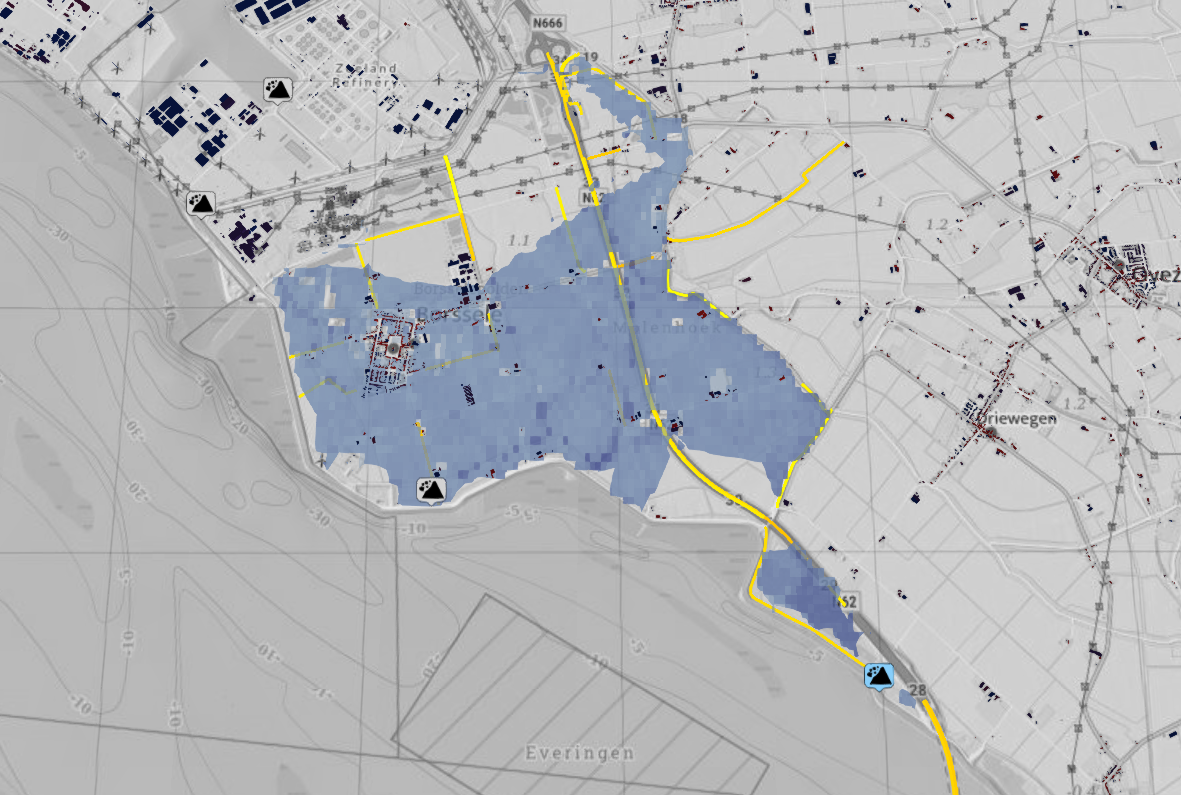
300 years
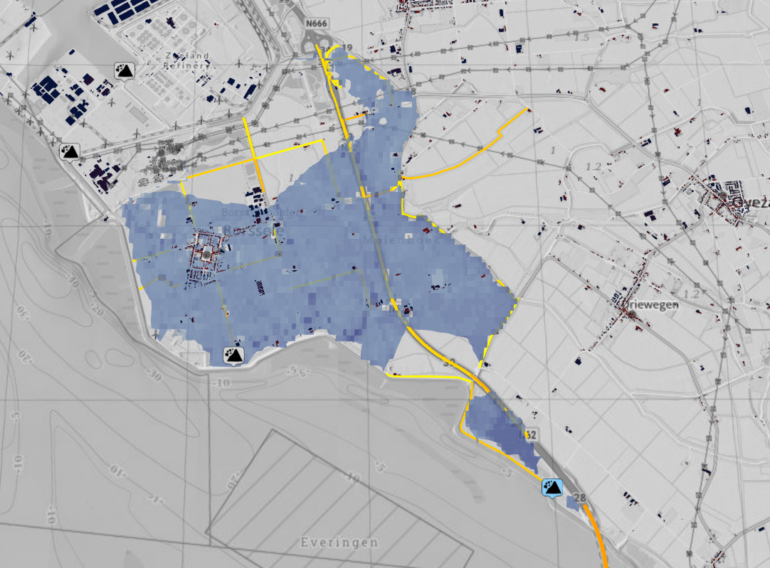
1.000 years
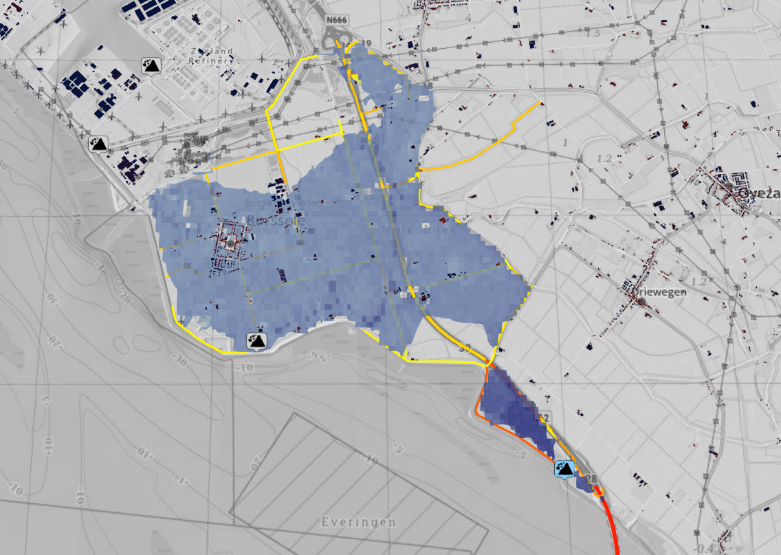
3.000 years
By mapping the risks, we know which roads to take.
Be ready, Be FIER