
At the ITS European Congress in Seville, the European Projects MegaBITS and MERIDIAN joined forces to present the new European Roadmap for Smart Cycling, hosting a dedicated session.
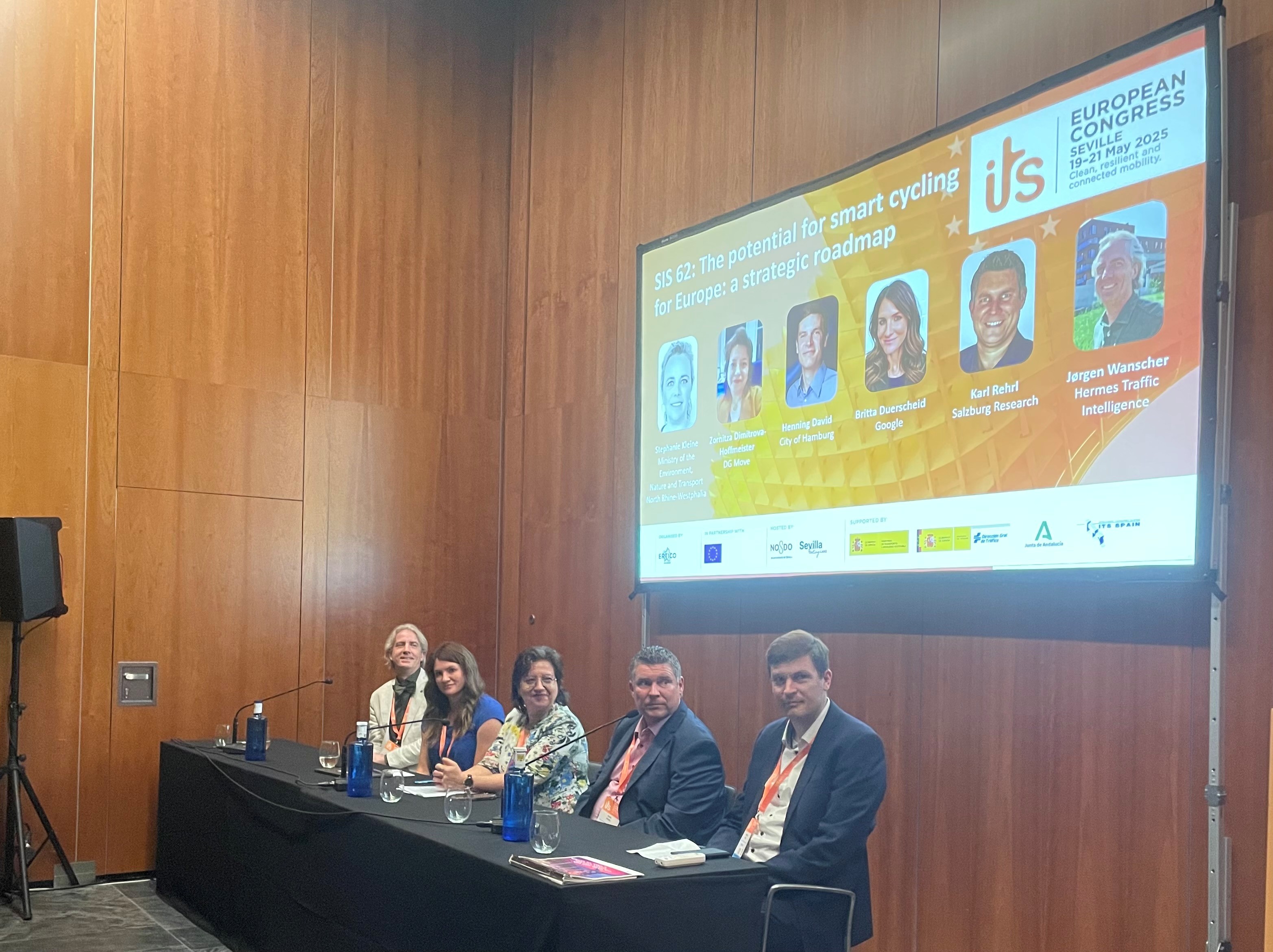
This session, which was moderated by Evelien Marlier (imec) was organised jointly by the European projects MegaBITS and MERIDIAN. The session was opened by Stephanie Kleine (Nord-Rhine Westphalia), presenting the Smart Cycling Road Map, which (in summary) lists 4 key actions for Smart Cycling:
- Improve safety and attractiveness of cycling by putting Smart Cycling on the policy agenda
- Foster innovation and digitalisation of the mobility system by stimulating the developments of Smart Cycling systems and services
- Enable Smart Cycling services by collecting and standardising cycling data and making it accessible
- Raise awareness of Smart Cycling by sharing knowledge and creating a collaborative Smart Cycling ecosystem.
Next, Ronald Jorna (Province of Overijssel) made the road map more tangible by presenting a wide spectrum of Smart Cycling applications already demonstrated in the BITS and MegaBITS project.
Then the floor was given to the panellists, who mainly focused on how they can contribute to realising the uptake of Smart Cycling. All the panellists highlighted the roadmap as a good working result and supported the requested actions.
Zornitza Dimitrova-Hoffmeister (DG MOVE) noted that the roadmap was well-received by the European Commission. She stressed the importance of cycling data and data standardisation, as well as the need to integrate (smart) cycling within the multimodal system. Henning David (City of Hamburg) would love to see the cyclists included in the C-ITS domain, not just as Vulnerable Road Users, but as a traffic participant in itself. He also highlighted the complexity of Floating Bike Data en the need for standards in this field. Britta Duerscheid (Google Maps) stated the need for a standardised description of the cycling infrastructure, and informed the audience about some of the challenges they encounter when adding the various types of cycling infrastructure to Google Maps. Karl Rehr (Salzburg Research) that the physical cycling infrastructure should come before the digital cycling infrastructure. But once it is there, data about the physical cycling infrastructure should be made available for the digital cycling services. And here, the ITS providers should work towards open interfaces in order to avoid island solutions. The last speaker was Jørgen Wanscher (Hermes Traffic Intelligence), who stressed the importance of cycling data in order to be able to show the value of cycling for society. In order to realise this it is important that stakeholders move from ‘involved’ to ‘commitment’.